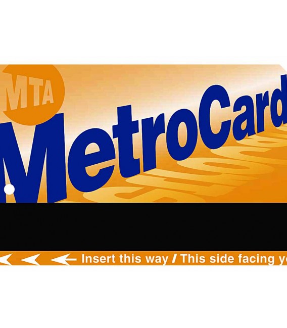
New York MetroCard entitles you to 7 consecutive days of free travel on New York buses (Local Buses) and subways (Subway). Indispensable to get around New York easily. The MetroCard is valid for Manhattan, Brooklyn, Bronx, Queens and Staten Island.
Unlimited travel on both Local Buses and the Subway. The New York underground is open 24 hours a day!
It is very convenient both economically and in terms of convenience. The ticket for each individual trip costs $2.90. The time and stress you save by not having to worry about ticketing is remarkable. Even catching a bus "on the fly" becomes easy.
The Metro Card is the natural "travel companion" to your New York Pass All inclusive or New York CityPASS.
- Home
- >
- United States
- >
- New York (view all)
- >
- New York MetroCard
Select destination
New products
-
47,00€90,00€89,00€74,00€
-
89,50€62,50€
New York MetroCard
Unlimited travel for 7 days on New York buses and subways
Express Courier
Highlights
- Unlimited travel for 7 days on buses and subways throughout New York City
- Save time by not having to buy individual tickets each time and avoid queues. You do not run the risk of buying a wrong ticket or fare
- Savings compared to buying ordinary tickets; three rides a day and you're already saving money.
- Each adult can accompany up to 3 children up to 44 inches (111 cm) tall travelling free of charge.
- You arrive in New York with your MetroCard in your pocket, ready to be used without any further formalities!
Description
How it works
You will receive your original New York MetroCard directly at the address you entered as the "shipping address" for use on the spot without any further formalities!
Activtion
The MetroCard is ready to use. Activated automatically the first time it is used
How to use
On the Metro
Swipe your MetroCard in the MetroCard reader: "GO" appears and you can swipe. If "Please swipe again" appears, swipe your MetroCard again or switch to another reader.
By bus
Get on the front of the bus and as you board the bus, hold the MetroCard with the black stripe on the right and the name MetroCard in front of you, insert it fully into the reader which is directly in front of you, it is automatically returned to you by the reader: you can then take your seat for your journey.
Validity
After the first use it will be valid for 7 consecutive days. For example: if you use it for the first time on a Thursday at any time, the card will expire at midnight on Wednesday.
Download
- Download Metro Map
Use the zoom and you will find that it is an important source of information.
More information
+info. How the underground works in New York.
656 miles of lines and trains running 24 hours a day!
Knowing New York Subway well allows you to get the most out of your MetroCard, minimise wasted time and enjoy its simplicity, convenience and the easiest way to discover New York.
Stations are marked on the map with a black dot if only local trains stop and with a white dot if both local and express trains stop.
The main feature of NY Subway is that there are slow trains that stop everywhere and fast trains that only stop at certain stations. The Metro Card is valid for both.
Express and local trains.
In our underground lines, you are standing on the platform and all trains run on that platform. This is NOT the case in the NY Subway: express trains run on tracks that are between the local trains. So if you are in a station for local trains only, it is very easy because you just have to watch the direction of the trains. If you are in a station where both local and express trains stop, you have to rely on the signposts.
To simplify things, the map does NOT have one colour for each line, but one colour for each GROUP of lines, so you will find the red line corresponding to lines 1,2,3, the blue line corresponding to lines A,C,E etc. The lines with the same colour have the same colour.
Lines with the same colour have the same path but diverge at the end. Be careful because even if they have the same route they do NOT make the same stops. Example: blue line (lines A,C,E) line A stops only at stations with white dots (express trains) while for lines C and E trains stop at all stations if they are local or only at stations with white dots if they are express trains.
Next to each station the lines that actually stop are indicated.
If you look closely at the map, you will see that the numbers next to the stops may or may not be in bold: in the first case, the line will stop at that station at any time of the day or night, seven days a week; if the number is not in bold, it means that the stop at that station will only be at certain times of the day or night, and only on weekdays or holidays.
On the same map you will also find, for the main stations, the buses that run and their direction.
Stations with the same name on different lines are often VERY distant from each other: the problem is that in Manhattan there are streets that run from left to right and Avenues that run from north to south in both cases for entire kilometres.
Normally you will find indications related to the neighbourhoods or areas of Manhattan, so you will find directions to the Bronx, Queens, Brooklyn, Downtown, Uptown... but also the streets that are the end of the line.
The MetroCard allows you to travel for 7 days. The card is also valid on buses, just insert it in the machine next to the driver when you get on. At least in this case, everything is very simple, as you only have to pass the card to the entry panel and that's it. Just one recommendation: to avoid abuse, if you enter a certain station and swipe your MetroCard, it cannot be swiped at the same station for the next 18 minutes. No problem, you're thinking, mistake! There are many stations where the entrance for trains going uptown is different from the entrance for trains going downtown, so if you make a mistake you CANNOT fix it by simply exiting and re-entering on the opposite side, but you have to wait 18 minutes before swiping again.
Cancellations and refunds
If you cancel your order before it has been shipped:
fixed administrative deduction of € 9.20.
If you cancel your order after it has been issued/shipped:
You can only return MetroCards if they are still sealed in their original individual packaging. This is the only accepted proof of non-use. You are responsible for the return costs.
A fixed administrative fee of € 9.20 will be charged.
- New York MetroCard allows unlimited travel on buses and subways for 7 consecutive days
- New York Subway entire underground network in Manhattan, Brooklyn, Queens, Bronx and Staten Island
- New York Local Buses entire city bus network
- MTA Staten Island Railway
- Westchester Bee Line Buses
- Roosevelt Island Tram and NICE Bus (Nassau Inter-City Express)
- Each paying adult may accompany up to 3 children up to 44 inches (111 cm) tall who travel for free
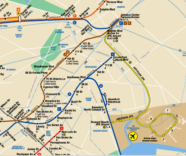
New York MetroCard is not valid for travel on AIRTRAIN, JFK's domestic connecting service. Cost $8.25 each way. To use this service you must purchase the appropriate ticket valid for one ride. If you need to make a round trip purchase 2.
AIRTRAIN connects all airport terminals with each other and with the Jamaica Boulevard and Howard Beach Metro stops.
See other products
-
The New York Pass All inclusive
GO City New York Pass. Free entry to over 100 of New... -
New York CityPASS® gives you free admission to 5 of the...
-
Save up to 37% on admission at 3 top attractions with New...
-
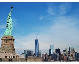
Statue of Liberty & Ellis Island Sightseeing Cruise
Canal Cruise a pleasant and relaxing way to discover... -
Visit the Edge Observation Deck, the highest outdoor...
-
One World Observatory - Freedom Tower
Admission and ascent to the 100th floor of One World... -
Summit One Vanderbilt Experience
Summit One Vanderbilt Experience entrance ticket -
The Empire State Building entrance ticket with access to...
-
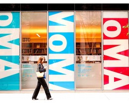
The entrance ticket to MOMA, the Museum of Modern Art in...
-
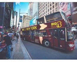
Free movement on the double-decker tourist bus New York...
-
Enjoy unforgettable views of New York City with the new...
-
Statue of Liberty & Ellis Island City Audio Guide
The must-have interactive app for discovering Statue of... -
Half-day city tour with guide in Italian!
-
Harlem tour with gospel choir - Sunday
Immerse yourself in the charm of Harlem and let the... -
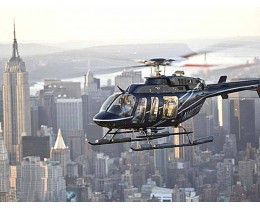
Fantastic helicopter flight around Manhattan
-
Triboro Tour (Bronx, Brooklyn & Queens)
It takes you on a tour of the Bronx, Queens, Brooklyn and... -
Washington Full Day Excursion from New York
Don't miss a day trip to the capital of the States -
Philadelphia and Amish County Full Day Excursion
Don't miss a day in Philadelphia and Amish Lancaster County -
5 Days tour to Niagara Falls, Toronto, Philadelphia, Washington and...
5-day tour departing from New York to Niagara Falls,... -
Boston Full Day Tour from New York
Start in New York and don't miss a day in the city where... -
The Hamptons, Sag Harbor Excursion from New York
Tours with departures on Tuesdays from June to September... -
Niagara Falls by bus from New York
Niagara Falls & Outlet Shopping 2 Days by Bus from New York. -
Newark Airport (EWR) - Manhattan airport bus
Direct bus connection from Newark Airport (EWR) to... -
New York Airports-Manhattan Private one-way transfers
Private, convenient and stress-free transfer from New... -
New York Airports-Manhattan - Private transfers roundtrip
Private, convenient and stress-free transfer from New... -
Discover a whole new world at Aladdin, the hit Broadway...
-
If you are looking for pure Broadway, than look no...
-
Discover the timeless tale of the Lion King, with this...
-
The famous Wizard of Oz, told from a different...
-
Always stay connected: your data wherever you are
- Home
- Limited Offer
- Airports
- Transports
- Attractions
- Tours & Excursions
- City App
- City Cruises
- e-SIM
- Sport & Events
- Musical
- GIFT CARD
- Blog
- Contact us
- Australia
- Austria
- Belgium
- Canada
- Denmark
- United Arab Emirates
- Finland
- France
- Germany
- Japan
- Great Britain
- Greece
- Irland
- Islanda
- Italy
- Mexico
- Norway
- Netherlands
- Poland
- Portugal
- Czech Republic
- Singapore
- Spain
- United States
- Sweden
- Hungary


